
For developers, investors and landowners in England
What Is Green Belt Land? Rules and Exceptions

Sviatoslav JerdetchiiCEO & Founder of Craftex. Updated , 8 min read
The short answer
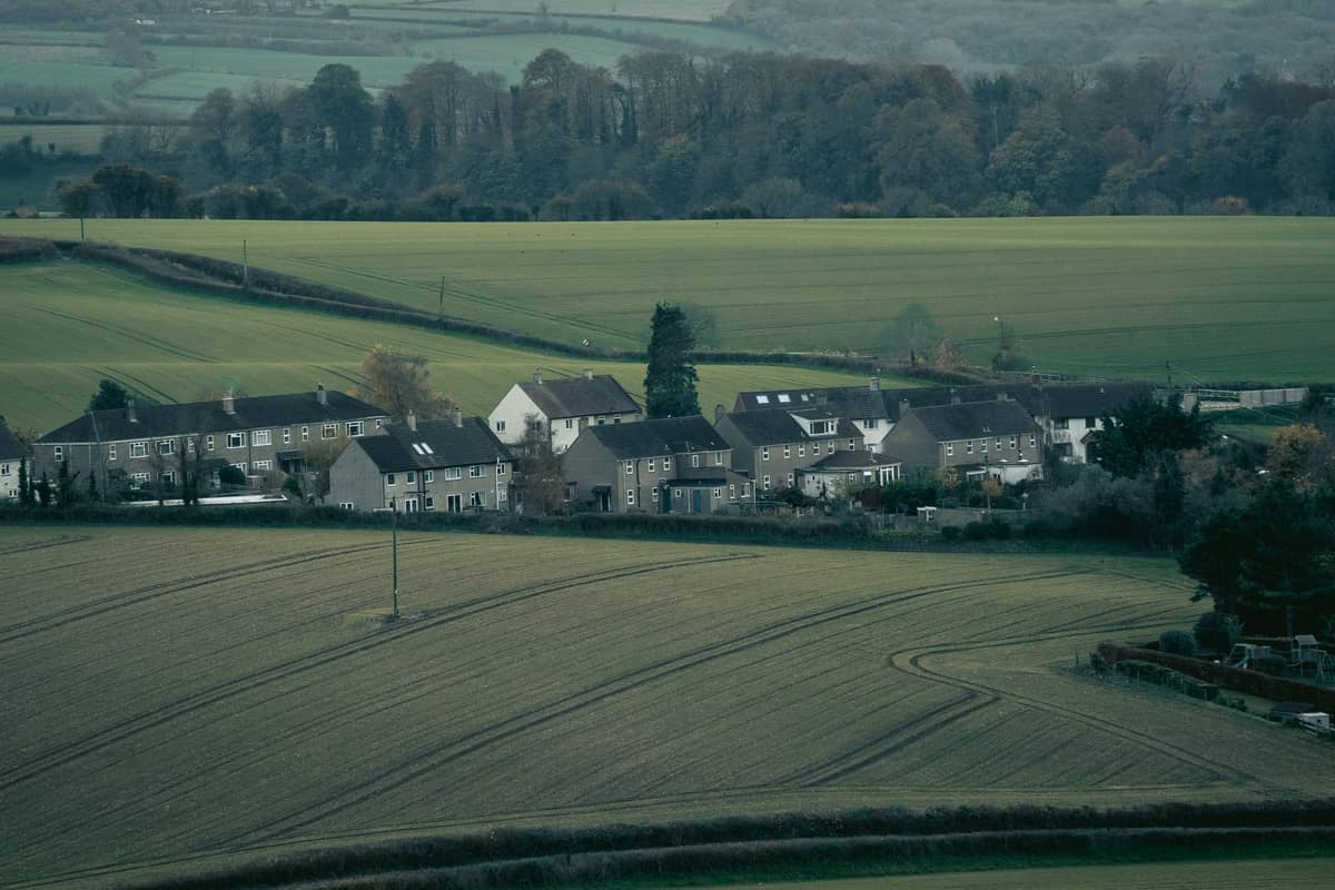
Green Belt is land that national planning policy keeps permanently open, to stop the sprawl of large built-up areas and keep towns apart. It covers around 12.5% of England, and building there is not approved unless it fits a listed exception or very special circumstances apply.
- The NPPF gives Green Belt five purposes, from checking sprawl to helping recycle derelict urban land.
- Policy GB7 lists development that is not inappropriate, such as farm buildings, limited infilling in villages and redevelopment of previously developed land.
- Grey belt land can be built on if a scheme passes four tests, and major housing must meet the Golden Rules.
- Green Belt is not article 2(3) land, so it does not remove permitted development rights by itself.
Green Belt is land that national planning policy keeps permanently open. It stops the sprawl of large built-up areas and keeps towns apart. Building on Green Belt land is not approved unless it fits a listed exception, or very special circumstances apply.
This guide covers England and the National Planning Policy Framework (NPPF) published on 17 August 2026. It explains the five purposes, the exceptions, grey belt, permitted development and the risks of buying.
Own a Green Belt field, or been offered one, and asking whether you can build on it? We find and test development sites for developers and investors, with the planning chance and our own build cost checked before you offer.
Rob Barton, our Development Director, steered planning for 10,000+ homes in earlier housebuilding roles. Been sent a Green Belt site? Ask for a free first view.
Green Belt meaning and the five purposes
Chapter 13 of the NPPF sets the aim of Green Belt policy. It is "to prevent urban sprawl by keeping land permanently open". The NPPF calls openness and permanence the essential features of Green Belts.
Policy GB2, paragraph 1, lists five purposes. Green Belt land is there to:
- Check sprawl. Check the unrestricted sprawl of large built-up areas.
- Keep towns apart. Prevent neighbouring towns merging into one another.
- Protect the countryside. Assist in safeguarding the countryside from encroachment.
- Protect historic towns. Preserve the setting and special character of historic towns.
- Recycle urban land. Assist urban regeneration by encouraging the recycling of derelict and other urban land.
Green Belt is a planning designation, not a type of land. Fields, whole villages and previously developed sites can all sit inside the line. The boundary is drawn in the local plan, and policy GB3 lets it change only through a new or updated plan.
Official statistics show a net loss of 480 hectares in the year to 31 March 2026. Seven councils adopted local plans that changed their Green Belt in that year. To see whether a site sits inside the line, check the Green Belt map and use the checks further down this guide.
NPPF 2026 exceptions: when you can build in the Green Belt
Policy GB6 is the starting rule. Development in the Green Belt is inappropriate unless it falls within a category in policy GB7. Inappropriate development "should not be approved except in very special circumstances".
Those circumstances exist only when the harm is clearly outweighed by other considerations. Under GB6, paragraph 2, substantial weight goes to the harm to the Green Belt, including harm to its openness.
Policy GB7, paragraph 1, lists the development that is not inappropriate. A scheme in one of these categories does not have to show very special circumstances.
| GB7(1) | Category | Main condition |
|---|---|---|
| (a) | Agriculture, horticulture, forestry, nature conservation | For those uses |
| (b) | Reuse, extension, alteration or replacement of a building | Permanent, lawful building; no disproportionate increase in size |
| (c) | Limited infilling in villages | The village lies within the Green Belt |
| (d) | Limited affordable housing for local needs | For example, a rural exception site |
| (e) | Redevelopment of previously developed land | No substantial harm to openness |
| (f) | Minerals, infrastructure, some changes of use, outdoor sport and burial facilities | Openness impact minimised; no significant conflict with the purposes |
| (g) | Development on grey belt land | Four tests, set out below |
| (h) | Homes or mixed use near a well-connected station | Within reasonable walking distance and well related to the station |
For category (b), the original building is the one that stood on 1 July 1948, or as first built if later. A replacement must be for the same use and not materially larger.
Category (e) is the one most developers use. It covers redevelopment of previously developed land, including a change of use to homes. The NPPF glossary excludes land last used by farm or forestry buildings, so a barn site does not count.
Category (h) supports homes near stations. The glossary sets a well-connected station as at least 4 trains or trams an hour overall, or 2 in one direction. Reasonable walking distance is around 800 metres. Our guide to the NPPF explained covers the rest of the Framework.
Grey belt: Green Belt land with a route to consent
Grey belt is still Green Belt. Annex B of the NPPF defines it as Green Belt land that is previously developed, or any other land. In either case, it "does not strongly contribute" to purposes (a), (b) or (d). Those are checking sprawl, keeping towns apart and protecting historic towns.
So a field can be grey belt when it does not strongly serve those three purposes. Purposes (c) and (e), the countryside and urban regeneration, are not part of the test.
A grey belt scheme is not inappropriate under GB7(1)(g) when all four tests are met:
- Grey belt land. The site is grey belt, and the scheme does not fundamentally undermine the purposes of the remaining Green Belt across the plan area.
- Unmet need. There is an evidenced unmet need for that type of development.
- Sustainable location. The site is in a sustainable location, with particular reference to policy TR3.
- Golden Rules. Major housing complies with policy GB8.
For housing, footnote 41 defines unmet need. It means the council lacks a five year supply of deliverable housing sites, with any buffer. It also applies where the Housing Delivery Test was below 75% over the previous three years.
Councils identify grey belt through a Green Belt assessment for the local plan, using the process in Annex E. The government's planning guidance adds that a grey belt finding does not mean a scheme "should" be approved "in all circumstances". The official statistics give no figure yet for how much grey belt exists.
Before you rely on grey belt, find the council's Green Belt assessment and read what it says about the site's area.
Craftex has completed a range of both small and large-scale projects on our commercial property with exceptional precision and quality. Dmitriy consistently delivers courteous, prompt service and has shown great flexibility in accommodating last-minute changes to plans and timelines. I highly recommend Craftex for their professionalism and outstanding workmanship.
Golden Rules for major housing in the Green Belt
Policy GB8 sets the Golden Rules. They apply to major housing on Green Belt sites under a planning application, and on land released from the Green Belt through a local plan. Major means 10 or more homes, or a site of 0.5 hectares or more.
All three contributions should be made:
- Affordable housing. The local plan figure for Green Belt sites, or until then 15 percentage points above the highest existing requirement, capped at 50%. Where no requirement exists, 50% applies by default.
- Infrastructure. Necessary improvements to local or national infrastructure.
- Green space. New or improved green space open to the public, within a short walk of the new homes.
A viability case is allowed in only three cases. The site is previously developed land burdened by costs the plan did not allow for. Or it is a strategic site, or a wholly different type of scheme from the one the plan tested.
Even then, the scheme should make the maximum possible contribution. The Golden Rules do not apply to permissions granted, or plans adopted, before 12 December 2024. Model the affordable share in your appraisal before you agree a price for the land.
Permitted development in the Green Belt
Permitted development rights come from the General Permitted Development Order 2015 (GPDO), not the NPPF. They allow set works without a planning application.
The GPDO cuts back some rights on "article 2(3) land". Schedule 1 lists that land: conservation areas, areas of outstanding natural beauty, the Broads, National Parks and World Heritage Sites. Land specified under section 41(3) of the Wildlife and Countryside Act 1981 is also on it. Green Belt is not on the list.
| Right | On article 2(3) land | On Green Belt land outside article 2(3) land |
|---|---|---|
| Class A house extensions | No side extensions, no cladding, no rear extension over one storey | The article 2(3) limits in A.2 do not apply |
| Class Q farm buildings to homes | Not permitted (Q.1(k)) | Not excluded by Q.1; prior approval needed |
Class Q lets an agricultural building become homes, up to 150 m² each. The total on one farm unit is capped at 10 homes or 1,000 m². It is not permitted on a site of special scientific interest, for a listed building, or on a site with a scheduled monument.
Prior approval under Class Q covers transport, noise, contamination, flooding, design and natural light. It also covers whether the location makes the change impractical or undesirable.
A council can still remove set rights in an area with an Article 4 direction. GOV.UK says work it covers "needs a planning application". Our guide to permitted development rights in London explains the limits for houses. Ask the council about Article 4 directions before you rely on any of these rights.
Buying Green Belt land: the risks
Green Belt land is often sold on the hope of a future consent. Check each of these risks before you agree a price.
- No category, no easy consent. A scheme outside GB7 needs very special circumstances, and substantial weight goes to the harm.
- Grey belt is a judgement. The council decides it, through its assessment or on an application. A grey belt finding alone does not secure approval.
- The need test can fail. The grey belt route for homes relies on a supply shortfall or a weak Housing Delivery Test. Check the council's latest five year supply position and result.
- Golden Rules cost. Up to 50% affordable homes, plus infrastructure and public green space, on major schemes.
- Farm buildings are not previously developed land. A yard of barns does not open category (e).
- Release depends on a plan. Boundaries change only through a local plan, with exceptional circumstances fully evidenced.
How to check if land is in the Green Belt
To check if land is in the Green Belt, start with the council's local plan policies map. The government also publishes the boundary data on data.gov.uk. Then check for a conservation area, an Article 4 direction and any listed building.
Our guide to buying land with or without planning permission covers the wider purchase. Rob Barton, our Development Director, took 10,000+ homes through planning in his previous housebuilding roles.
Own Green Belt land, or been sent a site by an agent? Send us the address or the pack and ask for a free first view. A director reads the planning position before you commit.
Before you buy Green Belt land
- The Green Belt line on the local plan policies map
- The GB7 category the scheme would fit, if any
- Whether the land is previously developed, by the NPPF definition
- The council's grey belt assessment and its five year supply position
- The Golden Rules cost on any major housing
- Article 2(3) land, Article 4 directions and listed buildings


